Friday, October 31, 2008

Telluride - What a Ride

Unplanned stops - they're always the best. On the suggestion of my host in Moab, I took the less travelled route toward Mesa Verde (one that was in the opposite direction). A beautiful mountain drive got me to Telluride, CO in about 3 hours. Angelo, my preplanned couch host suggested I meet him at a friend's place as he was providing some last minute assistance for Halloween costumes. Apparently he's a jack of all trades - a restaurant waiter by night, a tailor by day. The results were quite spectacular. A sexy Little Red Riding Hood / Wench Bodice for one, a cute princessy looking getup for a little girl, a glamorous gloved outfit for another. I don't know if he was getting paid but he certainly did a professional job. I joined him at the restaurant for a few hours, enjoying tapas and wine during happy hour. I then adjourned to the pad - a lovely 3 bed townhouse a few miles from town. My bed for the night was the loft above his bed. Lovely and warm being near the roof. Unfortunately, he neglected to inform one of his roommates I was visiting and that provided some friction this morning.
After a great motorcycle ride up a very rough road to the old Tomboy Mine 3500' above Telluride where it was snowing gently, I headed back to town and decided to leave. My next stop along the way to Durango was Trout Lake to visit Alan, an octogenarian I met at the restaurant last night. He lost his wife 3 years ago and seemed like he would like some company. He lives in an amazing home, at the 10500' foot of some 13500' mountains, overlooking Trout Lake, a town so small it doesn't actually appear on any maps, making it just a little difficult to find - but eventually I did. Apparently he's been house sitting for a couple of Brain Surgeons in California for the last 10 years. I have a private bed and bath with a spectacular mountain view (pictures may be forthcoming). We had a great chat about anything and everything. What better way to spend Halloween. I think I'll invite him to Georgia for Christmas.
Saturday morning will be an early crossing of the Ophir Pass (13000') which will take me just south of Chattanooga (CO, not TN) and into Durango to apparently assist with moving a fridge. The things I do for a bed......

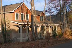
Thursday, October 30, 2008

Moab - Truly a mecca for trails

Arriving in Moab was a relief. Little did I know it was Jeep Jamboree weekend. Town was packed with people. Thankfully my arrival Saturday evening meant most of the crowd would be heading home Sunday sometime. Darrin, my couch host had another friend over so we all went on a 4x4 tour of the area Sunday morning, finishing with a visit to Dead Horse Point State Park, a great location overlooking the LaSal Mountains and the Colorado River.
Monday was time to go and play on the slickrock. Grateful for the new rear tire, the world famous Slickrock Bike Trail was a good introduction. Not technically difficult but ledges, cracks and long drops into canyons all take some getting used to. About 10 miles of some great scenery and wild up and down hills.
Tuesday was the real challenge for the bike and its rider. Poison Spider Mesa, Golden Spike and Gold Bar Rim, all trails connected to each other totalling about 16 miles of some of the most hard core riding I've ever experienced. These trails take a toll on your stamina and I couldn't imagine doing them in the middle of summer. This is definately a better time of year, afternoon temp around 75F. These trails include such known obstacles as Launch Pad and Golden Crack, a giant slice across the earth that will swallow a vehicle. It required either a 4' jump across the ravine or a delicate step up over some knarly boulders. Given it was toward the end of the day and I was already drained of energy, the step up seemed safer. Missing the jump would have just meant too much damage to the bike and probably me. At the end of it all was another 15 miles of dirt up to Gemini Bridges. All in all a great day that left me wanting nothing more than to sleep. As it turns out it was 15c wing day at the local pub so they dragged me down there for a few hours. Needless to say I slept well, with only mild lingering pains.
Wednesday was supposed to be departure day but after deciding to take the rack off the truck for some repairs it seemed a pity to not test it on the Hells Revenge Trail. Many ledges, steep ascents and descents plus other exciting and tough spots but there's one particular obstacle called the Dragon's Tail for which you're supposed to have a spotter. You're on a large slickrock plateau and drive toward the edge of this giant cliff, wondering when you get to turn away. At the very edge there's a small ridge (called a fin), near vertical, that goes down the side, barely wide enough for your tires. I was thinking a spotter would be nice but alas travelling alone has its occasional drawbacks. All's well that ends well and 5 hours later I was back on pavement. A challenge to be sure. Skid plates scratched but no damage and some great photos, very thankful for the tough stock equipment on my Tacoma.
With repairs made to my carrier, anti-freeze flushed and replenished in the bike and dust generally removed from the truck I was ready to go early Thursday afternoon. After a brief false start, realising I still had maps belonging to my hosts, I was on my way to Telluride, via the beautiful mountain towns of Paradox and Naturita. Many thanks to Darrin, Eric and Kate - my roommates for a few days in Moab.

Saturday, October 25, 2008

The Road to Canyonlands !!!

It's about 5pm Friday and I've made camp just outside Canyonlands National Park, having experienced a great hike in Natural Bridges from Sipapu to Kachina and a chat with a Kiwi couple who have been driving around in an RV for the last 5 weeks.
So far I've come about 40 miles of the 70 I will have to do on dirt roads to get to the Canyonlands Visitor's Center. The truck is already incredibly dusty inside and out.
With the exception of the occasional fly, the cooling metal of the truck and a gentle breeze on my face, it is ABSOLUTELY silent. A small bird just flying by sounds loud. It's so silent it seems as though I've gone temporarily deaf. I've descended about 3000' in the last hour coming over the mountain range but my ears have already adjusted. It's amazing and truly rare in the wilderness to hear nothing. I sit intensely still for a few minutes just feeling nature until the distinctive souind of dirt bikes breaks the peace. They go by, up the hill, and once again silence. Maybe it's something about the shape of this particular mesa because the sound of those dirt bikes disappeared very quickly. I feel the warmth of the sun on my back and a chill on my sandalled feet as the 58F weather dictates. It will be much colder as soon as the sun goes down, in about an hour. I'll eat before then and rug up in the back to read until bedtime.
It's pretty much a dawn to dusk lifestyle, repleat with all the experiences that provides - gorgeous sunrises and sunsets, much activity during the day and long sleeps as winter encroaches on the sun. I'm running out of time before snow season arrives in this part of the country. After New Mexico, it'll probably be a quicker trip home, although I'm still hopeful for that ski bunny who wants to take me in the for the winter :-)
The time here has flown by. Michigan back in June seems like eons ago and Kentucky with Frank & Deanna my first night seems dreamlike. Today has been full of spleandor, not the least of which was the drive from Natural Bridges to here, through Bear Ears and Gooseneck - great names. Thank God I have the ability to make this trip and appreciate the beauty and serenity it has offered.
Wow, Saturday has been a long day. Expecting the last 30 miles to the Visitors Center to be relatively quick, per my map program, I was somewhat surprised to find the road getting progressively worse as I arrived at Canyonlands South entrance. No ranger station, no gate, just a sign saying, "High Clearance 4x4 Only - Drive at own risk". Normally that would signal some fun but right now I have a motorcycle and carrier that makes the back of my truck 400lbs heavier and 3' longer than normal - not a good combination for hard core offroading. The road which I came to discover is rated as one of the most difficult in the Moab area, is know as Elephant Hill. It is incredibly steep, narrow, rocky and has multiple switchbacks that require 4 or 5 point turns. Needless to say I dragged my carrier many times, to the point where I snapped one ratchet strap, bent another badly and mangled or broke many of the bolts holding the carrier together. I also discovered later that somewhere along the trail I squished my exhaust pipe flat at the end. All that was just going UP the hill, I still had to come down.
Not prepared to destroy anything more, the small plateau at the top of Elephant Hill provided the opportunity to remove the bike and carrier and with some concerted effort get the 80lb carrier and all the cans - water and 2 fuel - into the back of the truck. The drive down the other side then became uneventful. A short hike back to the top to get the bike and it also made it down the hill without issue. Another hour or so and it was all back together at the bottom, ready to head on into Moab, still 100 miles away. Thankfully I had a couch host, Darrin, already lined up in Moab and the rest of the evening was comparatively simple.
The moral of the story - don't believe your GPS when it tells you the quickest way from A to B is via a dirt road.

Thursday, October 23, 2008

Navajo Nation

After my chores at the previous campsite, it was late in the day and Page, AZ arrived at just the right time. After restocking with groceries, ice and gas it was time to find another campsite. The timezones around here get screwed up pretty well, with Utah, Arizona and the Navajo Nation all different and right next to each other. After a quick visit to the Lake Powell visitors center I was told there was no camping except in designated sites, which meant an area called Lone Rock, a few miles down the road. My attention was drawn to a dirt road off to the left before I got there. 2 miles later I was perched on a mesa overlooking the entire area, Lake Powell, The Navajo Nation and GSENM, apparently there was other camping. That night it was cold enough to keep some ice I left out frozen all night long. I was in bed by dark - which as time zones go was somewhere between 6pm and 9pm, I'll never know.
Up before dawn this lovely Thursday morning, I got some great shots of sunrise over the surrounding valley. White fellas are not actually allowed to stay in Navajo Nation without permission so I want to get an early start to see all the sights in this area and out the other side before about 5pm. On my way by 7am it's off to the Navajo National Monument - Betatakin cliff dwellings and then Monument Valley.
The Navajo Monument was amazing. Two separate cliff areas, occupied from 1270 to around 1300. Because the cliff is so protective they're still in excellent shape - see photos. These Ancestral Puebloens (as I'm told is the politically correct term) lived for centuries in this area, mostly on the mesa tops. I'll see more at Mesa Verde in Colorado. From there, the drive through Monument Valley is surprising. There are Native American homes all around the monoliths, some right next to these giants. Unfortunately most of them these days are trailers, likely without running water. The plight of these peoples has not been a positive one since the arrival of white man.
Last place in the Valley was Moki Dugway. Imagine all those movies where they're driving incredibly close to a 1000' drop along a dirt road. It was just like that but even more incredible. The road twists and turns for about 10 miles straight up the side of a cliff face, turning out at the top of the giant plateau. I found a place to camp right on top, at the edge of the cliff, facing out over Monument Valley, just like all those car commercials.
It's about 7500', incredibly windy and so cold my pen doesn't want to write the notes for this blog. I'm in bed by 6.30pm and warmly rugged up inside my sleeping bag. My new LED headlamp works so well I'll read for a while. Tomorrow I head toward Natural Bridges and Canyonlands National Park.

Wednesday, October 22, 2008

Getting Used to Sand

Having been to this area earlier in the year, I figured I'd head toward the Southern part of GSENM rather than up to Bryce and Escalante. Heading through Kanab (originally given this is Utah I thought the town may be a shortening of Kane and Able, however I found out it's an Indian name, meaning Land of Willows) I played on a few trails looking for more hiking but came across nothing of interest. A little further down the road I found a 4x4 trail that was supposed to lead me to Middle Canyon, a spectacular narrows area. It gave me a great completely primitive camping spot but after 3 days of searching I never did find that particular hiking trail. I did find a bunch of other very cool locations, including Cottonwood Canyon and RT430 and 431.
My campsite overlooked the Grand Staircase of GSENM and was right in the middle of a giant sand field. No issue in the truck but quite a challenge on the bike. I got the hang of it after a day or two of realising you actually have to go faster to make it easier.
Today, Wednesday the 22nd, became chores day. I did some much needed maintenance on the bike after riding in sand for 3 days, cleaned up my camp and dusted the truck, also very much needed after the red Australian bull-dust like dirt roads. It's about 1pm and I'm just leaving the area. I'll head toward Page, AZ and Lake Powell.

Sunday, October 19, 2008

Kicked out of Zion

Friday night, my first night in the Zion National Park area I learned from my last trip here back in April and I camped in a small sandy spot about 5 miles from the entrrance. The National Park is right next to a town that gets very busy with tourists so I was just the right distance away.
Suprising for this time of year, but not so considering the gorgeous weather and a 3 day weekend for Utah schools, the Park was VERY busy. So much so I had to park in the overflow lot. You can't drive to any of the hiking trails in Zion. You have to park and catch a shuttle bus. A great idea to minimise the traffic and pollution. Catching the bus to "The Grotto" to hike Angel's Landing trail was fun, like one of those Japanese trains where they have to push people in. It was standing room only. I chatted to a nice young couple - McKenzie and Harrison - who were taking the weekend away from Brigham Young University (BYU, not likely to be confused with BYO in that particular location) in Provo to come hiking with some of their friends. We had some great discussions after the hike too.
Hiking those trails on a busy weekend involves quite a lot of waiting at the bottle neck places. Angel's Landing is steep but fairly simple until the last 1/2 mile which goes straight up a vertical ridge, only about 6' wide at times and a 1500' drop off both sides. It's quite the scramble (there are of course chains for the non-climbing types) especially when there's a line of 30 people coming down and just as many queued up to go up. An older guy (Bob from Salt Lake) in front of me was clearly not so comfortable with the heights so I offered to stay with him and talk him up and down. His young granddaughter of about 7 or 8 was having far less trouble and I enjoyed all their company for the duration.
After the hike I decided to cook dinner at a picnic table just beside the parking lot because it's tough doing it on the ground with my grill and no tables at the campsite I'd had the previous night. By the time I was done it was dark. Normally I'd go back to my previous place but I was planning on coming back to the Park the next morning. Unfortunately the campground was already full. The overflow lot for the campground had a few cars in it so I figured I'd just crawl into the back of my truck and nobody would know I was in there - WRONG ! Around 11:30pm I saw bright headlights and figured it was the Ranger checking the cars. I stayed quite still but I guess the officious little Nazi saw me in the back. He banged on the side and made me get up. He would listen to no amount of reasoning and wrote me a warning ticket and told me to leave the park until the morning. Being that late, I drove just outside the gates and parked on the side of the road with no more disturbances the rest of the night.
Saturday morning I went and parked in the same spot to have breakfast with a plan to hike the narrows, a cool slot canyon where you walk through waist deep water. However, the wind and general chilly weather dissuaded me and I headed off toward Grand Staircase-Escalante National Monument.

Friday, October 17, 2008

Vegas Nights

Arriving in Las Vegas early Thursday afternoon, I took an exit to find my bearings and ran straight into a Toyota dealership - convenient because I need an oil change badly. Being mostly without cell service, mum posted some Couch Surfing requests for me. Only one replied by the time it got dark and he thought I wasn't arriving for a week or so. I eventually got hold of him on the phone only to find out he'd just had a house full of Australians and didn't really want somebody again so soon. I spent that first night on a bluff in Kyle Canyon, eating cold tuna burritos and listening to a local radio show about how dismal the LV economy is right now, actually quite interesting.
Friday morning, having not had a shower in some days, my goal was to find one, plus a tire for my bike and a place to stay. None of those things worked out terribly quickly and by 2pm I was in a library using their wi-fi and thought I'd make a call to Jennifer's Hawaii sister Sheree, who we'd stayed with when here for a Suzuki conference a few years back.
Having discovered no tires available until Monday I ordered one through our own dealership supplier and asked for it to be drop-shipped to Sheree's place - having still not actually talked to her to confirm if I could stay. Always the optimist, I figured I could always just hang outside her place until UPS turned up if I couldn't stay with her.
As funny things go, I later found out she no longer lived there, but she was happy for me to stay with her. Luckily, she still owned the house and called her tenant and filled them in. Also good timing, Sheree had a 20th High School Reunion that night and invited me along. It was Homecoming and we went to a HS Football game followed by drinks at a local pub - all with about 50 complete strangers. They didn't stay strangers long. It was a great first night.
The plan was to stay with Sheree until Monday morning when my tire would arrive. As usual, plans change. After a great weekend of Sushi (yes, Monika, I went to Yama sushi again) and dog parks Monday arrived and the tire didn't. No problem - Sheree has a large new house and was fine with me hanging around. The tire eventually arrived Tuesday afternoon and then as luck would have it she had to go out of town to LA for business. Drew to the rescue - impromptu dog sitting added a few more days. I enjoyed my time with them - two fun and boisterous Weimaraners. We played fetch all day long and wrestled occasionally too. They were great but I still miss my cats. Did some needed maintenance on the bike, got ready for the next desert stint and all of a sudden I've been here a week. It's been a great fun time. Some good hiking and good exploring. Didn't visit a casino or the strip even once.
Friday morning and I'm heading out of town toward the Southern Utah National Parks.

Wednesday, October 8, 2008

Death Valley

After leaving Mt Whitney I enjoyed the always stunning scenery on the drive into Death Valley. At Panamint Springs the decision was made to camp at Mahogany Flats as I had last year. It’s about 8200’ and always cooler than the usual 100F in the Valley. It was a good choice. I met two groups of great people that night: Judy & Stow Chapman from Kentucky and 'The Crowd' at the top camp. Stow gave me some great ideas on places to visit in Utah and we all shared some great conversation and a taste of old port. Hopefully we can meet up again on our own coast someday. Then there was 'The Crowd'. A raucous bunch of retirees, celebrating Steve’s 66th birthday. He loves the area and told me some less common places to visit. I stayed with them until about 9pm and had breakfast with them in the morning. They were fun.

After breakfast I headed out for some remote exploring on the bike. It required some treks off map, cross-country. I made it back alive – just. After stopping at the ghost town of Ballarat and chatting with the old timer (you have to call them that here) running what resembled a store, he told me my choice of cross country treks would end at a 400’ drop into a ravine, not something I really wanted to do. My goal was to cross from the East side to the West side of Death Valley, using only old mining roads. It’s about 40 miles across and there are literally hundreds of little trails crossing the area from the Gold Rush days in the 1800’s. Of course most of them haven’t been used since then either and therefore are not readily recognizable. He suggested following Pleasant Canyon road (even though my map showed it stopped) and told me “if you knew where to go you could find your way across”. Of course I didn’t know where to go but I thought I’d try anyway. Well, I got through 2 mountain ranges and could see the road I was aiming for. Unfortunately it was about 10 miles west and 5000 feet down. I just didn’t have enough water or time before dark to continue exploring. It will have to wait for another trip. I made a nice meal and have plenty of ice to spend some more days here thanks to my friends from last night.
Today, Tuesday, I woke up with the sun, around 6.45am. I'll finish the sightseeing I planned, mostly on pavement so I'll actually get to see everything. Death Valley distances are much larger than they seem on most maps. I'll head to Titus Canyon through Stovepipe Wells and onto the town of Beatty, just outside the National Park, to fuel up. Well, having completed the Titus Canyon trip now I must say there was a bit of excitement. Having used more fuel than I expected yesterday messing around in the canyons, I got past Stovepipe Wells and was heading up toward Beatty for refueling when I hit reserve. With only 20 miles to go for Beatty I thought no problem. I was wrong. I ran out of gas about 4 miles later - in Death Valley, about noon, with the temp around 95F. At that point it was about 16 miles to Beatty and about 20 miles back to Stovepipe Wells, neither good pushing odds in that heat. I had passed an un-manned ticket station a few miles back and thankfully it was downhill. From there I would consider my options in the relative shade of the covered station. Long story short, I discovered the right hand side of the gas tank holds an amount that doesn't get picked up by the fuel tap. Removing the gas tank and tipping the fuel to the correct side helped somewhat, but I still wasn't sure if it'd be enough to get me the 16 miles back to the gas station. A few minutes later some people arrived to buy a ticket. As the Universe would have it, they were visiting from Brisbane, Australia. After some advice to them on locations to see, I asked if they would mind following me back to the gas station (they were heading that way anyway) just in case I ran out. I coasted about 7 miles downhill and then rode the last 9 through the hottest part of the Valley without issue. All was well but certainly taught me to top up my gas at every opportunity when in the Desert. If I'd run out on one of those back roads 20 miles from anywhere it could have been a much worse situation. I'm here now, back at camp, 6pm, dinner cooked and eaten, a Screwdriver happily behind me (the type with Orange Juice), windproof jacket, beanie and camo neck gator (Doug, remember me buying the hideous thing on our Blue Ridge Parkway ride last fall - it's been very useful) keeping me insulated from the wind and chill at 8200'. It'll be dark in about 30 minutes. I'll either read or just go to sleep. Decisions are simpler in Death Valley - mostly life, death or just irrelevant. I heard today the stock market had crashed again sometime in the last few days and it really makes no difference out here. The birds still chirp, the trees grow and my iPod still plays. Not sure if I want to rejoin the "real" world.
Wednesday morning now and the plan is to head to Las Vegas to get a new tire for the motorcycles on my way to Southern Utah. Choice is highway or a 4x4 trail that will take 4 hours longer. I'll let you know.....
As it turns out I didn't leave at all. While heading for the quicker highway route a small detour to Chloride Cliffs as suggested by Steve provided such amazing scenery I decided to stay another night. At the very cliff edge, about 5300' I camped at possibly the only place you can overlook BOTH the lowest and highest points in the Lower 48 - Badwater Basin at around -250' and Mt Whitney at 14,495'. This is Harley's place, the wind never stopped blowing.

Sunday, October 5, 2008

The Sierra Nevada's

After a brief explore and some consternation on direction, I decided to head up the Tioga Pass and into the East entrance of Yosemite. The weather is turning with a heavy snowstorm expected. The ranger at the gate said likely 6-8” tonight and if so they’d be closing the entrance – nobody in or out. I went in as far as Cathedral Peak, looked around for a little while and then came out to Junction Campground, a couple of mile outside. I figured if the storm doesn’t hit then I’ll go back in tomorrow. Junction is still at 9700’ so we’ll see. It’s getting very cold as I go to sleep. I expect it will snow.

Snow it did, Saturday morning about 6” covers the bike and car. I heard the snow plows around 4am and knew they’d be closing the Tioga Pass. Got some good photos going down the pass. When I got to the bottom I saw the road was closed, they were letting people out from the campgrounds but none back in. Lucky I didn’t stay in Yosemite.
I Met a guy at camp last night, Victor, a teacher from Fresno. He mentioned Mt. Whitney (highest peak in mainland USA at 14,495’) wasn’t far and only a 5 mile hike to the peak, although very strenuous. I thought I’d give it a shot. Arriving at the ranger station at Lone Pine, they told me it was actually a 22 mile hike Round trip, 16 hours minimum with a likelihood on snow in places plus a permit was required. I got a permit for the next day and figured I’d check it out. There’s a base-camp at around 8000’ so I’d stay there for the night. Arriving at Whitney Portal, I realize I’m not prepared for this type of ascent. People here have all sorts of weather equipment and I find out the trail I had wanted to take had 6 feet of snow on it. The bears in this area necessitate anything with a scent be placed in the bear box. It takes me the better part of an hour to remove all those things from my home on wheels and to have to do that again in the morning and leave my truck unattended for so many hours with so many lingering smells just doesn’t sit well with me.

I’ll head to Death Valley tomorrow and do some hiking there. It’s only about 120 miles. I’ll return here another time for this hike. As for tonight, hopefully the bears won’t care about the long life milk stored in the bowels of my truck.
I awake Sunday morning at 5am to people making noise, readying themselves for an early ascent. I stayed in bed until about 7. Weather is warmish and checkout not until 1pm so I’ll enjoy the beautiful views, read a little and sit in the sun.

Friday, October 3, 2008

Toiyabe National Forest - Talking Trees

Left Rubicon according to plan around 2pm. It took a lot longer than I expected to get to Highway 50. It’s a long and twisty road through the mountains. I started looking for a place to stay around 4.30. I have been feeling a little off so I forced myself to drink more water. The batch I have right now doesn’t taste so good which makes it tough. I asked the Universe for a place by 5pm. As I pulled off the road to let a faster car pass, I saw a little dirt road off to the left. It turned out to be a great area just about 2 miles up, part of the Toiyabe National Forest. There's one other vehicle parked nearby bt it's on the other side of a hill. This is truly primitive camping, just the ground and me. After making dinner I feel better. It’s getting cold anyway so I’ll turn in early and explore in the morning.

Had an amazing night. The tree I camped beside “spoke” to me. I felt an energy transfer like never before. Trees have so much inside of them we rarely perceive. It was an experience I hope to duplicate. After a brief explore and some consternation on direction, I decided to head toward the Tioga Pass and into the East entrance of Yosemite.

Thursday, October 2, 2008

The Rubicon Trail

After a couple of hours being unsure if I was in the right place I eventually found the famed Rubicon Trail on Tuesday morning. All variety of websites didn’t describe it enough for me to actually find it easily. Although it seemed like I was on the right path, the signage is non-existent. Part of the challenge probably comes from the time of year. There is simply nobody around here after Labor Day, and of course it’s also a weekday. Not a soul on the trail or in the campground. A quick trip onto the trail to see what it was like got me 2 miles (out of a total of about 12) before the KTM disapproved of the slow speeds by spitting radiator fluid on the ground. The trail is tougher than I anticipated. Copious numbers of basketball sized and larger boulders make it very slow work and exceptionally bumpy and tiring. The trick is to maintain speed but when there is rare relief in the way of a clear path that’s tough to do. Average speed is about 8 mph. My well-worn street tires on the bike don’t help much – I’ll definitely need a new rear before Moab. It’s been another beautiful day. I haven’t seen any rain for over a week. Camped overlooking Loon Lake. At 6450’ it will likely get chilly. It’s 5.30pm now and already I feel a breeze. I’ll get dinner going before sundown and probably be in bed by 8pm.

Rubicon Day 2
Practice has helped. Started around 11am, got the first 4 miles done in about 30 minutes. That’s when the bike overheated again. It has a radiator but no fan. I got as far as a huge pile of rocks called Little Sluice and decided it just wasn’t worth destroying the bike. It’s amazing how you get used to bouncing over rocks, just letting the bike find its path. After waiting about 30 mins for the bike to cool down I headed back. Arriving at camp around 2pm, the warm sun with a cool lake breeze, the only choice was to take a nap. An hour or so later I headed off to find some more ice. I’ll play on the trail back toward Wentworth Springs later. Maybe it won’t be so rocky. Back now from getting ice. What should have been a 20 minute drive turned into a 47 mile ordeal due to lack of signage and stores being closed for the season. I ended up stopping at a place that said closed and going in anyway. Lucky they were there and still had ice. There’s still nobody else around so enjoying the mountain quiet.

Rubicon Day 3
Went out early to try and avoid the heat. Heavily overcast it seemed perfect. Did about 7 miles on less rocky trails but never did find the campground that's supposed to be on the trail. Had fun exploring though. Couldn’t resist taking the truck a little way up the Rubicon. I went until the first time I had to use the diff lock and boulders threatened more damage than just ripping off one of my mudguards. Funnily enough, it happened as I was trying to make a U-Turn to leave. I got all of about 1/10th of a mile. It seemed further than that. It’s about noon now and I’ve had a leisurely breakfast. It’s getting much colder now and windy so I’ll head down the mountain and toward the east side of California, past Yosemite and along the Sierra Nevada’s toward Death Valley.